Thursday, July 18, 2019

Newfoundland Journey 2019 — Post #2

Newfoundland Journey 2019 — Post #2

I'm on a two-month journey to Newfoundland. Like Last year, my goal here is to post some stories, words and pictures, to document my trek to the Rock. 
You can click on any picture in the blog to blow it up. This year I'm shooting with my Nikon D800 and the new Nikon Z7, so if there's any quality issue, it's on me not the hardware! Most of the pictures will be available as large format prints at very reasonable cost. Contact me.


Newfoundland's Northern Peninsula

I love Newfoundland. I've often said I could live here, all things being equal. Not up here on the Northern Peninsula, though.

Maybe it's just because of the weather today (5°C, raining, 60kph winds...) but it's chilly here. And as you drive around from Raleigh to St. Anthony's to Goose Cove, you see piles of white snow and not just on North-facing slopes. When I asked Emily (my hostess here) about it, she said they had over 30 feet of snow this winter — that's over 10 meters — and it's not all going to melt. A typical mid-summer day up here is 10-13°C.

The terrain up here is sub-arctic. Actually in places it is more than sub-, it's downright desolate.


Ovefrlooking Great Brehat, north of St. Anthony. I climbed up to the viewing platform overlooking the town. The terrain is entirely rocky with pockets of tundra in between. Nothing grows up here more than a few inches high. That white spot you see is a semi-permanent snow patch. The intrepid climber is of course, me. 


I took these two shots in the Burnt Cape Ecological Reserve (BCER from now on so I don't have to keep typing the name in full!). This is mostly an expanse of gravel/rock interspersed by the odd patch of green arctic vegetation, lichen and the like. A lot of it is endangered and unique to this place, so you are enjoined not to leave the road, lest you drive over some rare species. More on this place to come. 


I struggled with the distinction between "Desolate" and "Isolated".  Another area is Cape Norman and the towns of Cook's Harbour and North Boat Harbour. Although they're only 10 km apart or so, the one gravel road feels much longer than that because there's NOTHING around you. This single 4 km spur goes only to the Cape Norman Light(house), essential for navigation years ago. The only man-made thing: the power line and the road surface which in spots is indistinguishable from the terrain around it. 


This image is just outside Cook's Harbour. You're looking East: the land in the distance behind the iceberg is the BCER. 


This is the town itself. Why would anyone live here? Well this was the nexus of the Cod Fishing industry back in the '80s before the shutdown and millions of pounds of cod was processed in the fish plant daily during the season. Now?

By the way, the little clump of stubby trees in the foreground is typical in the coastal areas but such copses are far apart and stunted.


There are critters that live in these little copses, including this large caribou seen at the BCER. 


Isolation is a recurring theme for me in Newfoundland. People choose to live FAR from any neighbours. In this case the owner was probably a successful fisherman but his property is miles from anywhere.


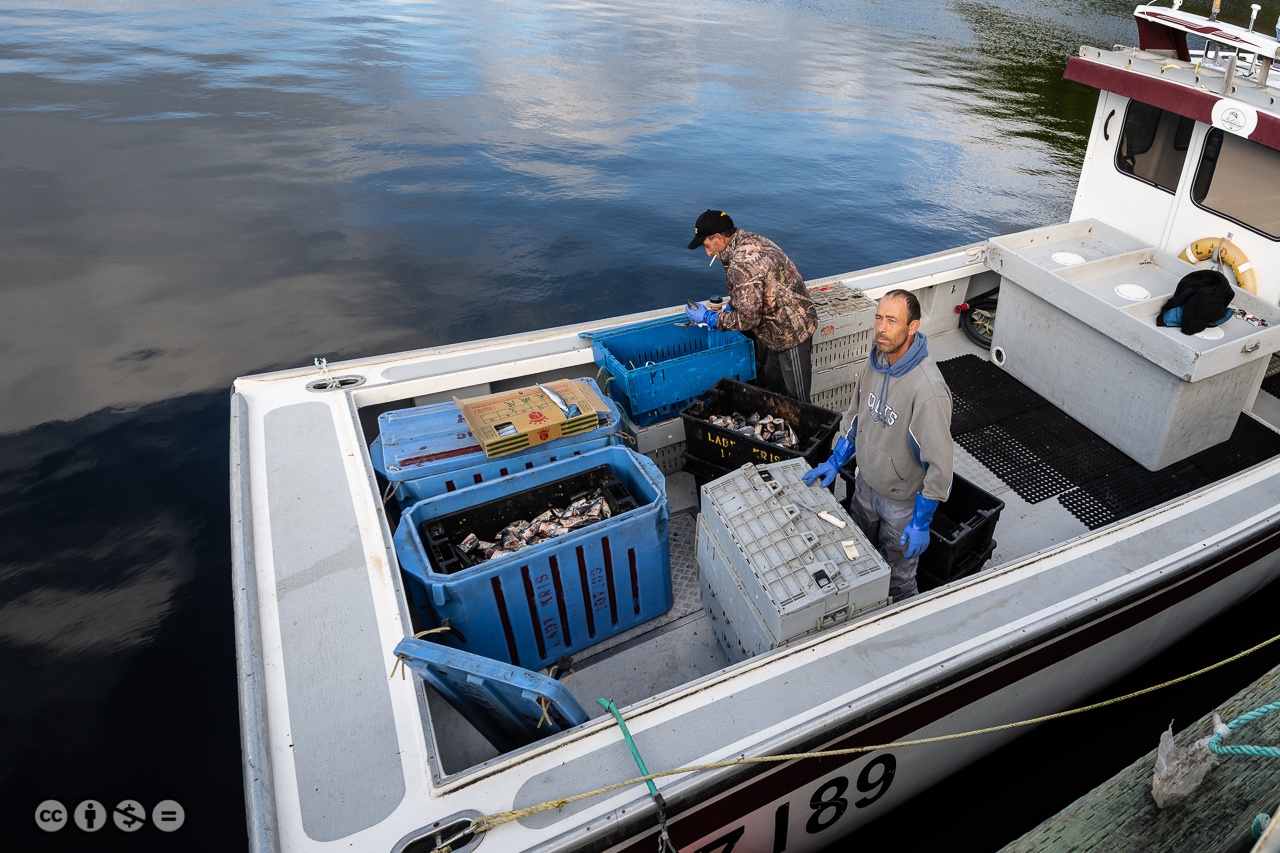
Here's a typical fishing stage and boat, all alone.


...and another one. This one's in Raleigh

St. Anthony is the only population centre on the peninsula with about 3500 residents and they actually have a Tim Horton's! And a real grocery store.


Taken from the Fisherman's Point Lighthouse a couple of km out of town.  


Back to the BCER...

There are hundreds of species of dwarf flora unique to this area and other arctic vegetation. Local guides can pick them out and Ted, who owns Burnt Cape Cabins, takes people out on his little school bus. The road is Subaru-friendly, I guess if you live there and know it well, school bus friendly too!


I didn't go with him because, as I explained, I need several minutes for each photo since I'm doing focus stacking on tripod. I stopped at this spot and was still there when he came back about an hour later. By the way, the 'nippers' or 'skitters' seem to thrive up there. DEET works, somewhat...

Here are a few images I took. I can't name the plants but at least one of them is rare, endangered. For my photography readers, I shot stacks of 20 images in the Z7 then compiled them in Helicon Focus back in the computer.


Lady Slipper 


This is a crop of the previous shot. It is one of the most endangered species there.


This is a carnivorous plant, about the size of my pinkie finger. The sticky interior traps wayward bugs. 


For more plant images, please see my portfolio page: https://glennspringer.myportfolio.com/newfoundland-2019


Viking stuff

The reason most people travel to the Northern Peninsula is to visit the Viking settlements at L'Anse aux Meadows. I was very disappointed. It's a government-run historic site, staffed by people in uniform, fancy displays, video shows and powerpoints... I didn't go outside the visitor centre building because (1) it was late, (2) it was far and (3) they admitted there's not much to see. The archeological sites have been excavated, you're looking at mounds and a few artifacts (they admit the major artifacts have been taken away). So you'll see a little triangular piece of rock that they say was a stone knife or arrowhead... not my thing.

However there's another site called "Norstead" (it has some Danish characters in the word that I won't even try) where they created a living replica Viking settlement, not just some archeological digs. Staffed by people in period costume, it was fascinating and I wish I'd spent more time there. 

They have an interesting website, it's worth the visit.


This is the "Snorri", a 50-odd-foot-long replica of the 'knarr' or ship Leif Ericsson used to cross the ocean from Iceland. They built this thing, took it to Iceland and sailed it back to Newfoundland using the original route the Vikings probably used. Imagine being one of the 30-odd crew of this open boat, crossing the North Atlantic in about 3 months, with no cover, no weather protection whatsoever. 


 Staff at Norstead are in period costume (well, except for the glasses, LOL). Very knowledgeable and friendly. ALL of them are local residents, most have lived there their entire lives.

Replica of a fishing boat or sealing boat they would have built after landing in the Snorri. The staff used this one here for several years before it was damaged in a winter storm. They're building another. 


Inside of a Viking church. 


More friendly staffers in period costume. Don't you love window lighting? 


Icebergs and other stuff

Here are a few more images before I close this chapter!


Seen off the far end of the BCER.  The other side was visible from Cook's Harbour.


You have to be in the right place at the right time. Hay Cove just before L'Anse aux Meadows. Stacked and digitally painted.


Crashing waves, long exposure using the ND filter. 


Parting Shots
On the side of the road

In the interior, away from the coast, there are more trees, thicker forest. As you drive along, you see garden plots, miles from anywhere, and stacks of firewood. Here's the story:

When they built the roads, the construction crews dug up and turned over fertile soil by the side of the road. Much easier to work than the rocky soil on which the settlements were built, so locals plant their annual vegetable gardens there instead! According to the notes I read, they're fenced to keep the moose out and away from their veggies — as if that's going to help! 


I think the 'scarecrow' is just for fun. Oh, wait. There are actually tons of crows and ravens around.

Homes are primarily heated by firewood. Other fuels are prohibitively expensive and so is electricity, besides these settlements date back over centuries. Every winter, local residents obtain permits to cut wood, and they go in cut and haul their wood out to spots near the highway. Historically, they used horse-drawn sleds to carry the wood (which was uniformly cut to 8-foot lengths). Now of course, they use snowmobiles and chain saws, but they still use the sleds! The wood is stacked and left to dry, some cut to 4' length or to the finished 16-18" length. Everyone knows where their own wood is and I'm pretty sure stealing someone's wood is a capital offence! Over the summer and fall, the now-dry wood is hauled and split and stacked again near peoples' residences. 


You can see the sleigh that is used to haul the wood here. Now hooked up to a snowmobile instead of a horse! Most of the wood in this picture has already been cut to length, but not yet split.


Along the roads are endless stands of birch trees, the main type of wood used. Softwoods, like pine, don't provide as much heat, burn faster and produce creosote and other harmful chemicals. The birches don't seem to be as bright white as the ones back home. 

Wow. I know this was too long. Sorry... but I couldn't figure out where to split it and as I wrote, I got carried away. Stay tuned for Part 3 in a little while!

— 30 —


Wednesday, July 10, 2019

Newfoundland 2019 Post #1

Newfoundland Journey 2019 — Post #1

I'm on a two-month journey to Newfoundland. Like Last year, my goal here is to post some stories, words and pictures, to document my trek to the Rock. 
You can click on any picture in the blog to blow it up. This year I'm shooting with my Nikon D800 and the new Nikon Z7, so if there's any quality issue, it's on me not the hardware! Most of the pictures will be available as large format prints at very reasonable cost. Contact me.


Quebec:

Zero photos (so far). I'm in Montmagny, QC, my targeted first night stop. Long day — about 10 hours drive. Somewhere around Brockville, the "Check Engine" light came on and disabled the cruise control. I've been having some issues, Subaru can't figure out what's going on. Nothing's open (Canada Day) so I figured tomorrow I'd find a dealer in New Brunswick and get it reset but like magic, when I got back in the car after a pee-break (TMI, I know!) around Quebec City, it reset itself. Here's hoping.


I keep telling myself I have to speak with more people. Here's what happened today. Driving into Montmagny, I hit a closed road, shut down for Canada Day celebrations. I speak some French but not at the speed the person directing traffic was speaking: and the accent! Pure joual (oxymoron!) too. A guy walked over and gave me directions in passable English. In the course of the conversation, I learned that he picked up English because he's a motorcycle collector and has to do deals in English, especially in the US! The pride and joy of his collection is a mint 1926 Indian.

I told him I'm an ex-motorcyclist/instructor. In passing I said I remember meeting a collector somewhere North of Kingston years ago and had a tour of his 'museum'. So this guy said, "Oh, Barry Brown. I saw him last week. His collection's grown, he has a bike dating back over 100 years that he's selling for $200,000."

We used to call that "Zen-Spotting". Meeting someone you know or one degree of separation away in a totally remote place. The Zen reference dates back to running into a fellow Zen Rider member in the middle of nowhere, hundreds of miles from home!

Every time I make the effort to speak with someone, a story results. There's a message here...

There are supposed to be fireworks tonight down at the marina. If I can stay awake, I'll try to get down there for some pictures. Stay tuned...

There were in fact some fireworks, plus a local band and food and beer and picnic... I took a few shots.


Nova Scotia:

Skipping ahead a couple of days, mostly spent driving. I overnighted in Moncton, NB then headed for Cape Breton in Nova Scotia. I spent the night at a B&B in Ingonish Beach (lousy bed, too high, too soft. But that's just me. BTW the NS Tourism people are the best: stop at a roadside info centre and they'll find you a place to stay!) then I drove the Cabot Trail loop, including a side trip up to Meat Cove. 

It's been a long time since I did this loop, worth every moment. If you can't make Newfoundland, at least go here. If you're on motorcycle, even better! And hint, drive the trail counter-clockwise, you see the scenery much better that way. A few highlight shots:


Lobster fishermen in Ingonish Harbour preparing the boat and the bait to go out. They leave around 3am, tend their traps and get back around 10 the next morning. They also pointed me at the best local restaurant in the area. 


Up around Bay St. Lawrence, this mail carrier told me he looked down to see where the next piece of mail was supposed to be delivered, then looked up and... nobody hurt, car was right on its side before he righted it, his buddy George was on his way with a truck to haul him out. 


The road to Meat Cove is mostly dirt, but they pave the steep sections, for winter I guess. This is a superbly motorcycle friendly section and you can see Cape Breton's awesome scenery. 


Newfoundland at last!

I got to North Sydney a little early, had a bite to eat, then headed for the ferry terminal. If you're going to take the ferry, here are a few insights:


  • If you're there early, your car's going to end up on "Deck 1" which is the lower sub-basement of the boat. You don't want that. First of all, they make you do all kinds of weird manoeuvres to squeeze in, including U-turns and parallel parking. Second you're the last one off the boat at the other end. Tell them at the booth, "I don't want to be on Deck 1" and they'll try to accommodate you.
However I was still too early so found myself at the front of the third line which would have put me down there. A friendly attendant let me move to a holding area (with people who had pets in their cars, so they wanted to help them disembark early). It was frustrating sitting and waiting there because you end up being the last cars loaded. However they put us on Deck 3 amid the transport trucks and we ended up being the first off the boat! Ask nicely...
  • For  $20 extra, you get reserved seating in a private area on Deck 9 (the top!). You get a reclining airline type seat (although there's something wrong with the shape, so it's really not fantastically comfortable. Better than sitting on a regular seat, though). Hint: it gets cold sleeping through the night (if you can!). They have blankets if you ask, but I brought my own. I also brought some Tim-Bits for breakfast instead of lining up at 6 am for an exorbitant brekkie. Timmie's is right next to the ferry terminal, you can walk over after you park.
  • Gas is 20¢ cheaper in NS than in NL. Fill up before you board. And the ONLY gas on the TCan is 28km up the road, and they don't open until 8am. So much for being first off the boat!


My first planned stop was Codroy Provincial Park beach where I knew there were endangered Piping Plovers, I'd shot them in previous years and if you look in the dictionary under "cute" there's pictures of plover chicks! I was too early for chicks, though, I think, because I saw a bird still nesting.


I saw and reported a banded bird and got an email answer back from Research Canada a few days later. Remember Piping Plovers are an endangered species.


Glenn – thanks! White flag AJ was marked as a chick in S NS (Louis Head), and seen that fall in NB and FL Atlantic; not seen last summer (often they don’t nest as yearlings so we may not see them); seen spring 2019 in GA, and has spent the summer at Codroy Valley Prov Park, although I don’t know if she has actually nested.


Arjuna and Jacqui were there, just winding up their trip. They were flying out of St. John's in a few days and had to get under way. We had a quick brekkie, then I headed for Stephenville where I was spending the night. Pretty tired from lack of sleep on the ferry, I took a quick afternoon nap then headed out to my next planned spot, Cape St. George on the Port au Port peninsula.

Tim Horton's first, of course. Just an observation: it seems everywhere you go, your nostrils are assailed these days with the smell of burning oregano. Oh, wait, it isn't oregano... just hoping these folks don't hop in their car and drive high. I used that incident as the basis for a short story I started yesterday (or maybe chapter 1 of a novel... we'll see).

On the way there, I stopped at Hidden Falls. We'd been there before but couldn't see the falls. Um, I parked, got out of the car and there, straight ahead of me... Too far for a good photo but I gave it a shot with the ND filter on the 200mm lens.


Cape St. George was outstanding. Not the town, BTW: the campground right on the point. I had been hoping for a sunset and wasn't disappointed. Not only were there lots of birds flying around, but I spent quite some technical time putting together some hi-tech shots.


This was an HDR pano, comprising 5 sets of 3 shots stitched together in Lightroom and then I added some finishing touches with Topaz Studio. This is going to be a VERY large print! 


Not quite so complicated, this is a merge of 3 bracketed shots in order to capture the sunset colours and detail, and the cloud patterns. 


Sunset silhouette. I left the third person in the image because I thought it adds to the story. If you haven't noticed, this is my new (for now!) blog header photo.


Next morning, I headed up the coast towards Port au Choix, where I spent two nights en route to the North end of the Western Peninsula.  On the way, I stopped at the Arches park, where I found this interesting crow and later, along the route, this Common Eider duck. Common for some, new on my lifer list!


Why am I tempted to caption this, "Counting Crows"? 


That's enough for now! To be continued in the next edition of the Blog. Stay tuned...


— 30 —